Monday, November 21, 2011

Buckskin Gulch and The Wave

I can't believe we have been here for 2 years and hadn't made this trip yet!  Just a little north and west of Page, AZ across the UT border is the Coyote Buttes area.  This place holds some amazing sights from alien like sandstone formations to the longest slot canyon in the world.  It's a hikers paradise!

We made the long road trip up from Tucson on 11/19/11.  A quick few hours of sleep in Page and we were off to trail head.  We chose to take the Wirepass trailhead first to "The Wave."  It was a bit tough to stay on any specific trail but once we saw the notch in the rock it was easy to track down.  Based on the GPS the actual wave area was mainly SSE from where the trailhead veers off out of the wash.  The Wave was simply amazing and if you haven't been you need to go NOW!

After the wave we trekked back with hopes to drop into some slot canyons.  We eventually found a way down back into Wirepass and took it over to the intersection with the Buckskin Gulch trail/slot.  This area is amazing with the walls closing in to no more than 2 feet and soaring hundreds into the sky.  There are even some cool petroglyphs on the wall at the intersection of Wirepass and Buckskin on the right wall as you are coming out of the slot canyon from Wirepass.

I will let the pictures tell the story.

Heading towards the Wave

Sandstone formation getting close to the Wave

The Wave

The Wave

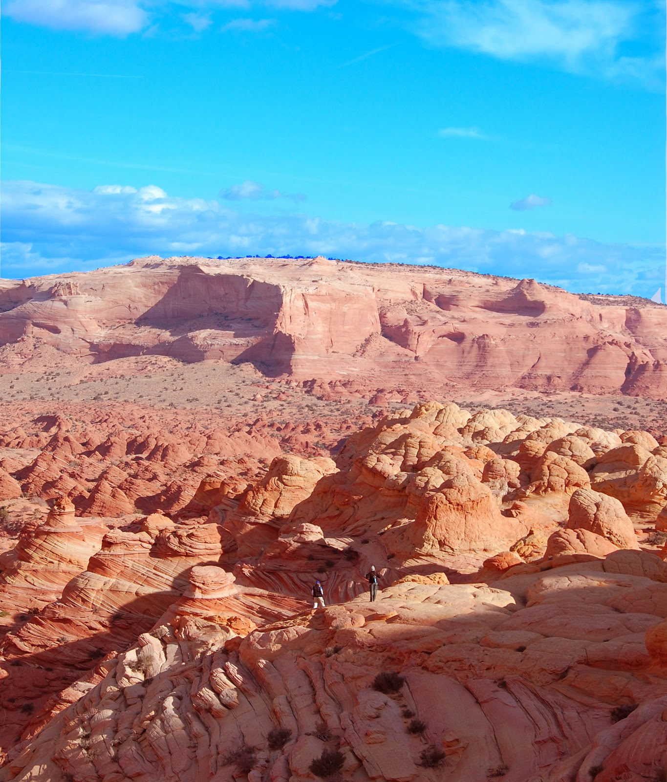
Looking back over Coyote Buttes from the Wave 

Katie in the Wave

Heading in the slot canyons

The crew in Buckskin Gulch

Slot canyons on the Wirepass Trail

Petroglyphs

Sunday, July 10, 2011

Mt Lemmon 7/9/11

Finally the monsoon has shown itself and the hiking trails on the Catalina mountains have opened back up.  We took quick advantage to get out of the heat for a little while and headed up the mountain on 7/9.  We hit the always trusty Marshall Gulch area.  Surprisingly it wasn't that crowded!  We decided to head up the Aspen trail this time for a change of scenery from Marshall Gulch.

It was 72 degrees to start the hike.  What a great change from 102 that is was back at the house in Tucson.  The trail was nice and great, full of life.  The gigantic swarming flies were a little bothersome at times but as long as we kept moving they weren't too bad.  We found a little horny toad who let us get close and personal.

Horny Toad in Catalina Mountains

Max, the Chocolate Lab, was pretty wooped just after climbing up Aspen.  I guess it was still a bit hot for him.  We decided to head back down Marshall Gulch trail instead of heading to Lemmon Pools this time.  Either way it was a nice escape for a couple hours and some decent exercise.  Already looking forward to the fall!


Sunday, April 17, 2011

Grand Canyon Photos

My sister and nephews came out to Arizona for the first time.  We had an adventure filled few days!  Here are some great pictures of everyone at the Grand Canyon.


Friday, March 18, 2011

Cibeque Creek/Superstitions Hiking

I am super late in getting my report up from last weekend.  We hit Cibeque Creek and then drove back through the superstitions!  Cibeque Creek is about a 3 or 4 hour drive from Tucson.  We went through oracle, Globe and then into the Salt River Canyon.  Heading North, as soon as you pass over the bridge there is a dirt road that heads left/west.  Head down that road about 4 miles unless you come to a creek crossing.  It was probably 6 inches or so deep and this is actually Cibeque Creek.  Cross the creek and park on the right.  From there we hiked up the creek for a mile or two.

Katie relaxing in Cibeque Creek
The scenery was great, the water was cold!  After a while of trying to help the dog scale up the rocks I gave up and just started walking in the creek.  I can't imagine the water was much more than 45 degrees.  It was freezing!  We hiked a ways from there but got to an area that was tough for the dog and eventually turned around.  We didn't make it to the slot canyons I had read about so we'll definitely be going back sometime soon.

Since it was early we took the really long way home.  We heading back to the west and down past Roosevelt lake and dam.  From there we headed up the 24 mile long Apache Trail in the Superstition Mountains.  It was a long ride but we were rewarded with some great views from a nice flat area towering above the canyons near Tortilla Flat.  If you have some time i definitely suggest driving the trail!
Max posing at sunset on the Apache Trail outside of Tortilla Juntion


Friday, March 11, 2011

Organ Pipe Cactus/ Ajo Peak Hike 3/5/11

Big Organ Pipe Cactus at the beginning of the hike
It had been about a year since we drove from Tucson down to Rocky Point, Mexico.  This drive takes you west out of Tucson to Why, AZ and then you head south into Mexico from there.  Right before the border you pass through Organ Pipe Cactus National Monument.  Since that trip I had been wanting to make it back and try out the hike to Ajo Peak.  The mountains have a totally different color and style to them as compared to the Tucson area mountains.

Since the elevation in this area is pretty low is gets really hot in the summer so please don't try this hike between May and September!  I would rate this hike as difficult due to the steep areas and loose gravel.  It gave me a good workout!

We started at the Estes Canyon trail head and headed up from there.  There was a pretty strong border patrol presence in the area but outside of that we only saw one other group of hikers all day.  It was a really windy day and until we got into the canyon it felt like 40 mph head winds which made for some challenging hiking.  The canyon itself is just amazing with different colored walls.  The hike ended up being a lot more challenging than I had expected.  The first mile or two up to Bull Pasture was pretty easy.  From there you wind around and then into the canyon.  That's where it got tough.  Going up the canyon walls up to the rim was really steep with a lot of loose gravel.  Going down was definitely trickier than the ascent.  However the views you are rewarded with at the top are amazing.  There is a really neat window in the rocks as well.  From the top of Ajo Peak there are amazing views of the surrounding desert, Mexico and Arizona.  Definitely a trip worth checking out.

Katie near the top of Ajo Peak


Neat sandstone mountain you pass by on the way up.

The window is big enough to get into for the brave!

Looking back down into the canyon.

The way back down looking back into the valleys


Sunday, February 27, 2011

Tucson Mountain Weekend

I know I seem to post a lot about hiking in the Tucson Mountains but a) they are basically in my backyard and b) they just don't get enough PR as everyone is always talking about the Catalina's.  I thoroughly enjoy hiking out here in the winter and the crowds are minimal.

Tucson Mountain Wash Hike
On Saturday we took all of the dogs for once and headed up to a wash just across from the Desert Museum.  If you go over Gates Pass and then make a right on Kinney just after the desert museum there is a parking lot on the right.  Park here and follow the trail head down into the wash.  From there just follow the wash uphill for some great secluded scenery.  There are a few areas where the wash has created some interesting canyons and colors.  It's an interesting little hike for a mile or two up  into the mountains.

Saturday night a storm rolled through and we awoke to snow in the Tucson's!  This is a rare event so we rushed out the door to get out and hike before it melted away.  We headed up the Hugh Norris trail, one of our favorites.  After reaching the first saddle we were greeted by great valley views of the snow covered Tucson and Catalina Mountains.  We hiked from there about another half a mile to the second saddle.  After that the urge to explore our own path took over and we headed up a couple of peaks off of the trail.  We found a couple of nice "windows" in the rocks and had a good time scrambling up the mountain.

Snow!!

Love the Saguaro!!

Another window in the mountains

Window in the side of the Tucson Mountains

Great view of the Tucson and Catalina Mountains

Sunday, February 6, 2011

Hugh Norris Trail - Tucson Mountains

We took a quick morning hike on the Hugh Norris trails yesterday in our backyard - the Tucson Mountains.  We have hit Wasson Peak a couple of times before but not sure if we would make it today.  We brought the puppy with us and his paws sometimes get sore quickly on the rocky hikes out here.  The weather was great in the upper 40's when we started.  We ended up making it a quick fitness hike to the saddle of the other trails and headed back from there as Max started showing signs of his paws getting tender.  A beautiful trail with great views of the Tucson mountains and the surrounding valleys.  The Hugh Norris trail really offers some great desert views and some fun off trail rocks to scramble up.  Check it out before it starts heating up out there!

Wednesday, January 12, 2011

Sedona Mountain Biking

Well as I am sure you have read we have put many many miles on our hiking boots.  With some encouragement from friends we recently invested in a couple of used mountain bikes and thought we'd give riding a shot.  We have done a couple trails in the desert in Tucson so far.  It's flat out tough.  Just a wee bit different that riding on asphalt!  Anyways, we decided to head to Sedona last Saturday to try a couple of beginner trails.

A quick 3.5 hour drive north out of Tucson and we were at the Bell Rock pathway trail head around 10am.  From what we had read the Bell Rock trail was really the only "easy" trail in Sedona which is known for it's world class mountain biking.

Even the slight uphill of this path for some reason was a bit grueling on the bike to start.  I guess there just much be some muscles I am using on the bike that I don't use other wise!  Well long story short is the uphill was tough but extremely rewarding as the downhill parts of the trail were just downright awesome.  If you are a beginner i definitely reccomend you hit this trail.

Of course don't forget about the beauty of Sedona.  We took a couple side hikes climbing around the amazing red rocks.  What a great place!

And also a big thanks to the Fat Tire Bike Shop in Sedona for the quick repair around lunch time.


Thursday, December 9, 2010

Thanksgiving in Utah - Day 2 in Bryce Canyon

After a great hike in Zion and a great Thanksgiving dinner just outside of the east entrance we slept like babies.  The Best Western at the turnoff to 9 turned out to be a great deal for 60 bux a night.  Rooms were perfect!  We got up early the next morning and hit the road for Bryce Canyon.  It isn't too much more than an hour or so to the north and the drive was quite nice.

Getting started at Bryce Canyon on the Peek-a-Boo Trail
We were greeted by single digit temps and thick snow all over the Bryce Canyon area.  It is much higher in elevation than Zion - 8000ft+ at the top vs. 5000ish around in Zion.  We decided to try the Peek-A-Boo trail which is a 5.5 mile loop through the heart of Bryce Canyon.  Like all of the hiking trails in Bryce Peek-A-Boo starts at the top of the canyon walls and descends drastically.  The thick snow made it a real challenge in a lot of areas.  Some of the unpacked snow was over knee deep and kept our pace pretty slow!  However the snow really made the area beautiful.  I had been here before so it was great to see the mars-ish terrain covered with white!  I wish we would have brought some skis - quite a few good opportunities for some downhill cross country action!


The hike was amazing.  I think my GPS said we lost and gained overall about 2000ft of elevation.  The rock formations and windows were just amazing.  If you haven't been there you have to visit!  The peek-a-boo trail was great!
Wall of Windows - Bryce Canyon
Just getting started but a great view of the canyon.

Sun rising through the hoo-doos

More great shots of the red walls in Bryce canyon

Great photo of the sun shining off the snow in Bryce

Name that rock...


Thick snow!

Wednesday, December 8, 2010

Thanksgiving Day - Zion Canyon, Utah

We decided to forgo the normal Thanksgiving holiday and spend a few days in the Zion and Bryce canyon area in Southern Utah.  I had hoped that we would be able to camp and spend a mini-fortune on gear the week earlier.  The weather had different plans for us as a blizzard blew through Utah the day before we got there.  Instead of temps in the 30's at night it was into the single digits.  Time to change plans!

We arrived at Zion Canyon Lodge at 8pm on Wednesday to spend the night in a warm cabin and then give hiking a shot in the morning.  We woke to -12 degrees!  Wow - truck would barely start.  We go a warm breakfast, bundled up and headed into Zion.

Walter's Wiggles
We headed up towards the trail to Angel's Landing.  The hike was cold but great until we got to the Walter's Wiggles area.  It was completely iced over and as slippery as can be.  We were able to slowly make our way up the 20 switchbacks knowing heading down would be much more challenging than going up.  Once through there we quickly realized that the treacherous last half mile on Angel's Landing wasn't an option.  It was completely iced over!  It's tough under great conditions, no way I was trying it covered in ice!

We decided to head up the West Rim trail and explore areas where we haven't been.  This turned out to be a great decision. We only saw a few people along the way.  It was mostly covered in snow but not packed to the point where it was too slippery.  The various lookouts over the canyon along the trail were just amazing.  The snow actually really added to the beauty of the area.

Getting started towards Angel's Landing

Along the West Rim Trail in Zion National Park
Snowy conditions in Zion


Day 2 we headed to Bryce Canyon...