Sunday, November 25, 2012

Rose Canyon Lake - Mt Lemmon Hiking

Rose Canyon Lake is located 30 miles from Tucson, AZ in the Santa Catalina Mountains near Mount Lemmon. Rose Canyon Lake is the only lake in the area that has recreational fishing. It is a pretty small lake (7 acres) and is set in a picturesque stand of  ponderosa pines up near Mt. Lemmon.  There are quite a few hiking trails in the area, and a pretty easy trail that goes most of the way around the lake except the damn in uncrossable.


We headed to rose canyon on November 25, 2012.  Most of the area had already closed for the season but we were able to hike down to the lake.  The area is a great place for the dog to take a swim!  Not sure where else in the Tucson area we can do this.  There were about a dozen people around the lake fishing but still plenty of room for max to take a swim.  Weather was perfect, the water in Rose Canyon Lake was probably around 50 degrees.  Max enjoyed it a bunch!


My dog swimming in Rose Canyon Lake
Max swimming in Rose Canyon Lake

Katie hiking around the edge of Rose Canyon lake


Saturday, November 10, 2012

Madera Canyon - Dog Friendly Hiking November 2012


The first cold front of the winter finally arrived today.  A bit of rain and cooler temps means we can finally take the dog out to a few trails that he doesn't prefer in the summer.  Madera Canyon, south of Tucson in the Santa Rita mountains, is one of the most scenic areas around town.  It's a great area but there isn't much
Dog friendly hiking at Madera Canyon in Southern Arizona
Max checking things out at Josephine Saddle
water as you climb the trails and the dry hike slowly irritates the dog's paws.  Temperatures around 40 with a little rain and snow made it perfect.

To get to Madera Canyon, drive south out of Tucson on I19.  Take the exit in Green Valley for Continental Road.  Make a left off the highway and follow the signs about 13 miles up to the canyon.  You'll pass a few trail options and a couple of B&Bs before the road dead ends at the Old Baldy and Super trail heads.

We opted to take the Super Trail from the trail head.  This is a great trail, winding about 3 miles up the mountain to Josephine Saddle.  Along the way there are great views of Mt. Wrightson, the tallest peak in the area.  There was a bit of water in the creek on the way up today.  Under dryer conditions the first water you'll get to is at Sprung Spring, almost all the way to Josephine Saddle.

Picture of Mt. Wrightson from the Old Baldy Trail
Mt. Wrightson from the Old Baldy Trail
From Josephine Saddle there are a number of connecting trails.  You can opt to hike another 3 miles or so up to the summit of Mt. Wrightson.  A challenging hike with another 2500 ft of elevation gain, but amazing views of the surrounding area even down into Mexico from there.  We took the Old Baldy trail back down to the parking lot.  Tallying a total of 5 miles and close to 2000 ft of elevation...just about as much as Max could handle before his paws starting getting a bit sensitive.

Here are a few pictures from the hike:

hiking the super trail in madera canyon
Looking back towards Green Valley from the Super Trail

Hiking in Madera Canyon with our dog
Max and Katie hiking up the ridge

Max and Katie getting some water at a creek in Madera Canyon


Monday, October 22, 2012

Tucson, AZ Fall Colors Update - Mt. Lemmon - October 2012

Update 11/4  - Most of the colors on Mt. Lemmon are gone.  It was a good season!

Quick update. Fall colors are peaked out at the top of Mt. Lemmon outside of Tucson, AZ. We hit the Marshall Gulch trail head on 10/21 and snapped the pics below. Not too bad for Tucson!

Tucson AZ Fall colors October 21 2012
Fall colors at Mt. Lemmon

Marshall Gulch colors October 2012


Wednesday, October 17, 2012

Rocky Mountain National Park Hiking, Estes Park Colorado

Chasm Lake on the way to Longs Peak
Looking down into Chasm Lake
We took a long weekend trip the last weekend in October to get some hiking in.  Luckily work had me in Steamboat Springs for a few days and made it easy to extend the trip into the weekend.  Neither of us had been in Rocky Mountain National Park before so we very anxious to get this trip in.  Being a bit late in the season we were hoping that we got to see some of the fall color before it was gone and also got to hit the trails before the snow covered it up too much.  The weather forecast was a bit iffy with a 50% chance of snow in Estes Park.  We awoke in the morning with decent weather, so it seemed, so we decided to give it a shot.  Most of the fall colors were gone, but we got pretty lucky with some good hiking weather at the start of our hike.

Our trip started at the Longs Peak parking lot/trail head.  Luckily the weather forecast must have scared off most of the casual hikers as the parking lot was for the most part empty at 10 am.  From what I read this isn't usually the case at Longs Peak as it's one of the busier trails in the national park.  Their loss!  We certainly weren't prepared to hike to Longs so we chose Chasm Lake as our destination for this trek.  The Chasm Lake hike is about 9 miles round trip and you gain about 2500' in elevation.  It isn't too challenging, but the wind and snow once we came above the tree line made it a little rough.


As you come up to the top of the ridge about 3.5 miles in you'll reach an intersection.  The trail to Longs peak goes to the right and the Chasm Lake trail heads to the left past a bathroom.  Follow this route down to the lake.  The new snow and storm surely gave us some unique views and photo opportunities.  The weather was pretty good until we got near the lake.  Once there a storm blew in with 30-40mph winds and heavy snow.  I can't imagine it was more than 25 degrees outside at the same time.  A bit cold especially with the wind.  We snapped a few pics and quickly heading back to the shelter of the tree line.  All in all it was a great hike.  The snowcapped mountains really created some amazing views and pictures.  If you're in the area I certainly recommend to heading up to Rocky Mountain National Park and hiking up to Chasm Lake.

Video of the weather:


Here are some pics from the trip:

Chasm Lake hike photos
Looking down into Chasm Lake as the snow storm blew in
Chasm Lake trail intersection with longs peak
Katie at the first intersection with the storm starting to move in
Snow storm at Chasm Lake near Longs Peak
Heading back in the storm
Hiking to Chasm Lake Rocky Mountain National Park
Above Chasm Lake on the ridge

A quick video of the Chasm Lake hike I found on YouTube.

Monday, October 8, 2012

Tucson, AZ Fall Colors Update

10/8 - Tucson , AZ - Headed up to the top of Mt. Lemmon this past weekend and hit the Aspen Trail and Marshall Gulch trail.  The Aspens have just started to change the leaf colors.  Most some yellows but there were definitely some good areas along Marshall Gulch with oranges and reds.  We probably still have 2 weeks until the fall colors peak.  Either way the weather is perfect for hiking!

Saturday, September 29, 2012

West Fork of Oak Creek - Hiking Pictures/Report October 2012

It was a perfect weekend to check out  and hike West Fork of Oak Creek in Sedona.  The fall colors haven't really hit yet but the weather was perfect.  Make sure if go on this hike that at the end you head through the creek up around a couple corners to see the best sights of the trip!  The main trail ends after about 3.5 easy hiking miles.  From there you can keep going a ways but it is off trail and just cruising through the creek.  We trekked another 1/4 mile and the views were great.Your feet will get wet but it's worth it.  Also, this hike is very dog friendly.  There were a number of people with their dogs our on the trail.

Oak Creek Canyon hiking
Katie and Max at the end of the maintained part of the West Fork trail

photo of West Fork of Oak Creek Hiking
Just getting our hike started at West Fork

Photo of our dog hiking in Sedona at oak creek

Nice slot canyons at the end of the hike

Picture of Max and Katie in Oak Creek Canyon

Wednesday, August 8, 2012

Top 10 Arizona Hikes

Over the last 3 years we have explored most of Arizona from our home in Tucson.  Most of that time has been spent on numerous hiking trails around the state.  I think we've hit every trail in the Tucson area and picked some of the highlight trails from everywhere else.  From low desert, steep peaks and alpine meadows Arizona offers some amazing diversity when it comes to hiking and the outdoors.  Here are our top favorite hikes so far, more coming soon!

Mt. Wrightson is dog friendly!

Hike #1 - Mt Wrighton


Tucson, AZ - Starting at the trail head in Madera Canyon, this challenging hikes climbs over 4000 feet over just a bit more than 5 miles to the highest of the Tucson area mountains.  Starting at over 5000 feet this is doable in the summer due to the coolers temperatures at elevation.  From the top of Mt. Wrightson on a clear day you'll see up to 100 miles in any direction with 360 degree views.  This is a scenic, challenging and fun hike.  The quickest route is to take the Old Baldy trail all of the way to the saddle.  Optionally you can use the super trail which adds on more distance but isn't quite as steep.  To make a nice loop take Old Baldy up and the Super Trail back down.  Give yourself 8 hours and bring plenty of water.


Hike #2 - Chiricahua - Heart of Rocks Loop


Chiricahua Hoodoos
From Willcox, AZ take hwy 186 to 181 to the entrance of Chiricahua National Monument - This isn't your typical AZ rock hike.  Chircahua is full of amazing hoodoos and rock formations throughout the hike.  It is truly some unique scenery that you won't find anywhere else.  We have not been there since the 2011 fires but surely it has not affected the uniqueness of the rock formations scattered throughout this loop hike.

Balance Rock, Chiricahua National
Monument, Arizona
There are a number of ways to see the area but the Heart of Rocks Loop is one of the best.  This 8.7 mile hike goes through the best of the area.  Start at the Echo Canyon parking area and then onto the Echo Canyon Trail.  After 1.6 miles along Echo Canyon trail, take the Rhyolite Canyon and descend around 400 ft over a mile or so to the Sarah Deming trail. Heading out of the canyon again, you gain about 900 ft while walking 1.5 miles to the best part of the hike, the Heart of Rocks loop. The Heart of Rocks loop is 1.1 miles and showcases  the most impressive rock formations in the monument.  These include Duck on a Rock, Punch and Judy, Camel head Rock, Pinnacle Balanced Rock,  and more. The entrance to the loop is well marked. After you finish the loop continue along the Balanced Rock trail to the east. After hiking 1 mile along a relatively flat section, the trail descends back down into an canyon just after the Inspiration point trail head junction. Another mile and you reach the last junction. Turn North and hike along the Ed Riggs trail the final 0.7 miles back to the original trail head.


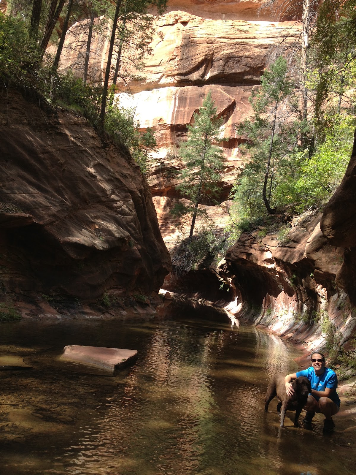
Hike #2 - Aravaipa Canyon

Aravaipa Creek December 2011
This hike is easy to find but probably a long drive from anywhere you live.  It's between Mammoth and Winkleman off of AZ77 north of Tucson.  Turn east on Aravaipa Road.  About 12 miles and you can't miss the trailhead.  The dirt road is a bit rough the last 6-8 miles or so.  Keep in mind you must register through BLM to enter the area and it is limited to 50 hikers per day.

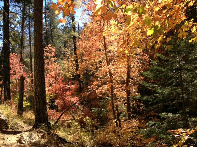
There isn't a specific trail to this area.  It follows the creek back in 12 miles or so through a number of canyons and great areas to explore.  I especially enjoyed this hike in the winter as there were some great colors still to some of the trees.
A shot of the scenery near the trailhead

Mt. Rainier, Sunrise/Skyscraper Hike and Photos July 2012

Being on the road for work all of the time surely gets old quick.  Fortunately for me sometimes I get to visit places that offer some fun things to see and do on the weekends.  I got lucky and had a conference in Seattle in July.  No matter what this would be a nice escape from the dreadful heat in the middle of the summer in Tucson.  Why not make a weekend of it?  80 degrees or 105?  Pretty easy call.  The summers in Tucson get old quick and I'll do anything to escape!

Katie flew out to meet me on Thursday night.  We spent most of Friday bumming around downtown Seattle seeing the usual tourist sites.  Ate some good seafood, oysters, cruised Pikes market, did the Seattle underground tour (it was ok but I am just not a tour kind of person) and saw what we needed to see of Seattle the city.  After a week in the city I was ready to get out into the woods!

Hiking through a snowfield at Mt. Rainier
Having never spent any time in the area previously we decided to make visiting Mt. Rainier National Park our first stop.  We spent the night in Puyallup and awoke early on Saturday to hopefully beat some of the crowds.  We opted to drive to the east entrance of the park basically taking highway 410 all of the way in.  I had numerous recommendations on starting at the Sunrise area for the great views and hiking options.  I knew it would be busy but getting there early paid off and there were only a handful of people at the Sunrise lot/trail head around 8:30am.  It was a bit foggy, but I'll take hiking in the fog vs. hiking in a crowd all day long.

Mt. Rainier sunrise hiking trail head in fog
Leaving the dog covered trailed at
Sunrise in the AM
The initial plan was to hike up to Frozen Lake and take the trails up in the Burroughs Mountains from there.  The trail up to Frozen Lake was fog covered in the morning only opening for a few moments with amazing views of Mt. Rainier.  We made it up to Frozen lake in no time with not a single soul to be found.  It was great!  From there we headed up the Burroughs trail.  After a half mile at most we had to cross a snow patch on the steep trail.  It was a bit nerve racking without any real gear for it; only one person had trekking poles.  The girls got a bit nervous through there and when we made it to the next snow patch they said "no way" and we turned around.  So much for hiking up the Burroughs!  Even in mid July definitely look for a snow report and come prepared!

Sign at Burroughs Mountain Trail
We were warned!
We then trekked back to Frozen Lake and then towards Skyscraper Peak we headed.  As we entered the fields the wildflowers were blooming and the views were amazing.  We crossed a few more snow fields but mostly on flat ground so nothing that posed much of a problem.  By mid morning the fog and clouds gave way to spectacular views of Rainier and the surrounding area.  Treading through the snow fields had wore the group down a bit so we ended up heading down into the meadows of Berkeley Park instead of going to Skyscraper Peak.  The area offered some great views and the wildflowers were in full bloom.  We hiked around this area a bit before heading back up to Frozen Lake.

Upon returning to Frozen Lake the crowds had shown but so had the views we missed on the way in as the fog had cleared.  Some amazing scenery down into the valleys there looking back towards Sunrise.  We got some great photos before deciding to head back to the trail head.  We only had one weekend in the Seattle area and figured if we called it an early day it would give us time to hike another area.  So off we headed to Olympic National Park!

Some great info on hiking Skycraper:  http://www.visitrainier.com/pg/hike/50/Skyscraper%20Pass%20/%20Peak/

Some pictures from our hike on Mt. Rainier:

Mt. Rainier National Park
The crew at Frozen Lake, Mt. Rainier National Park
Picture of Mt. Rainier with wildflowers blooming
Wildflowers blooming with Mt. Rainier in the distance

Great views of Mt. Rainier
Berkeley Park, Mt Rainier National Park Hiking

Mt Rainier Burroughs Mountain Hiking Trail
Snow field going up Burroughs Mountain


Wednesday, July 25, 2012

Olympic National Park - Sunset Pictures

We had an amazing time visiting and hiking in Olympic National Park last weekend.  You couldn't have asked for better weather.  While the park was pretty crowded earlier in the day almost everyone left well before sunset and we mostly had our hike to our selves.  The wildflowers seemed to be in full bloom which just added to the picturesque scenery.  We just did the Hurricane Ridge trail due to time constraints but can't wait to get back and hike on some of the others.

Here are a few pictures from our sunset hike at Olympic National Park in Washington State.  More photos coming soon!

Olympic National Park Hiking Picture
Trail to our self just before sunset.
Sunset at Olympic National Park
The Olympic park snow covered peaks in the distance as we watch the sun set.
mt olympus at sunset picture
Looking west towards the Pacific over the Olympic range
Olympic National Park Wildflowers
All of the wildflowers were in full bloom
Picture of a Marmot at Olympic National Park
The Marmots were not very camera shy!

Photo of a Blacktail Deer at Olympic National Park
Black tail deer getting close for a nice picture.
Katie enjoying the evening.  Probably one of my favorite photos all time.

Olympic National Park wildflowers on Hurricane Ridge
Sunset in the background and wildflowers in the foreground.
Katie hiking through a field of wildflowers.


Sunday, July 8, 2012

Aspen Trail - Mt. Lemmon, Tucson, AZ

Aspen Trail Tucson AZ
Views early on from the Aspen Trail
The Aspen Trail is another great starting hike that connects with a number of other trails at the Marshall Gulch Saddle in the Catalina Mountains. All of the trails in the area are dog friendly.  In the summer it seems everyone out hiking has their dog with them!  It is a 2.5 mile hike to the Saddle on the Aspen Trail.  The Aspen Trail starts at the Marshall Gulch trail head at the very end of Catalina Highway.  This trail begins just behind the parking lot and has a sign as it begins.

fall foliage aspen trail
Fall foliage on the Aspen Trail
The Aspen trail ascends fairly quickly up through the pine forest and you are quickly rewarded with great views of the area. It's pretty tough as it begins especially with it being high in elevation but it eventually levels off.  As you continue to ascend you'll go through a couple of Aspen groves.  In the fall they usually have some great colors and make for a very scenic hike.

As you continue past the Aspen you'll eventually hike up to a ridge area.  From here the trail levels off.  The trail climbs and descends with the ridge in the area but nothing as steep as it was at the beginning of the trail.  Eventually the trail connects with a number of other trails at Marshall Saddle.  Taking the Marshall Gulch trail back down to the parking lot makes for a 2 hour 4 mile hike through the area.

Check out some more pics off the Aspen Trail in the fall.

Marshall Gulch Hiking - Mt. Lemmon, Tucson, AZ

Marshall Gulch - Fall Foliage on Mt Lemmon
Marshall Gulch - Fall Foliage
The Marshall Gulch hike is by far our favorite place to start in the Catalina Mountains. It starts from the very end of Catalina Highway and winds up a creek through the pine forest. Outside of mid winter when Marshall Gulch is generally covered in snow this is a great trail for all seasons. Marshall Gulch also connects up with a number of other trails in the area.  It's a great starting point.  Be careful in the summer as parking is fairly limited and it fills up quick!  We especially enjoy bringing our dog on this trail as it offers plenty of water, shade and cool temperatures year round. Marshall Gulch also usually has some great fall foliage starting in late September.  A lot of the area here is still covered by dense forest without too much effect from the fires years back.  

There are 2 different spots where you can start the Marshall Gulch hike.  The official trail heads straight up hill to get started.  You can also take the lower trail straight behind the restrooms that stays along the creek.  Both trails eventually intersect with each other a little ways in so you'll end up at the same point either way.  We normally choose to stay near the creek so the dog always has a good water source!

Another fall shot at Marshall Gulch
The trail intersects with quite a few others about 1.2 miles in at Marshall Saddle. From the saddle you can take the Aspen Trail back to the Marshall Gulch parking lot, head deep into the Catalinas with the Wilderness of Rocks trail and eventually to the summit of Mt. Lemmon. We normally head about a mile down on Wilderness of Rocks to seem fairly deep pools of water to let the dog swim before heading back. There are some nice deep pools here especially in the summer during Monsoon season. Watch out for the little frogs that like to nap along the rocks. You won't be able to see them until they are jumping on you.

Heading back down to the parking lot through the Aspen trail provides some different scenery. In the fall the Aspen groves are sure to offer some great colors. This trail is a bit longer than the Marshall Gulch trail and offers a bit more elevation change and in turn burns off a few extra calories too.

Hiking Reports:  Marshall Gulch Hiking July 2011  and Fall Foliage on Mt. Lemmon

Friday, July 6, 2012

Escape the Summer Heat in Tucson on Mt Lemmon


It's seems that so far this summer the heat has been even hotter than usual in Tucson.  I don't remember the temperatures being over 105 so consistently in June before.  Where there's a problem there is always a solution.  Thank fully Mt. Lemmon never fails to deliver a nice escape from the heat of the desert summer.

At the summit Mt. Lemmon towers over 9,000 feet in elevation.  About 7,000 feet higher that Tucson temperatures are usually about 25 degrees cooler at the top.  From the drive, hiking trails and shops in Summerhaven there are endless activities for everyone.

One of my favorite parts of the trip is the drive up Catalina Highway.  Also known as General Hitchcock highway Catalina Highway climbs over 6000 ft from the desert to forest over 27 miles.  An endless route of panoramic views from highway pull offs you can see the entire area without much effort.  The road itself is in great condition, has wide bike lanes and plenty of pull offs for slower vehicles.  For those of you who like a twisty road Catalina Highway is somewhat of a holy grail.  I haven't found a road more fun to take the Porsche on anywhere near Tucson.

There are numerous hiking trails the entire way up.  From desert hikes covered with Saguaro cacti to Pine covered trails there is always a perfect trail regardless of the weather in the valley.  Here are some of our favorite hiking trails on Mt. Lemmon:

Marshall GulchEasy1.2 miles600ft gain
Aspen TrailModerate2.5 miles1800ft gain
Upper/Lower Green MountainModerateVaries
Rose Canyon LakeModerateVaries

Quick Mt Lemmon Hiking Video

Wednesday, July 4, 2012

Tucson / Oro Valley Flash Flood - July 4th, 2012

We got over 3 inches of rain in about an hour today in Tucson and Oro Valley.  This is the first time I have seen flash floods happen so quickly in town!  The washes instantly turned into rivers and flash floods even in our neighborhood in Oro Valley.  Here is a picture of the wash that runs through our neighborhood Copper Creek and a video as well:

Flash flood in wash in Oro Valley.  This is normally a nice little path we walk the dogs through!


Flash flood video July 4th, 2012 in Tucson / Oro Valley

Another video of the monsoon flooding in Oro Valley July 2012

Oracle State Park Hike


Tossed the dog into the Porsche and headed out for a hike.  Yes, we can fit the dog in the Porsche!  We made the quick trip up to Oracle State Park in Oracle, AZ.  This state park had been closed due to AZ state budget cuts.  It recently reopened in Feb 2012 and is currently only open on Saturdays.  If you haven’t been there you should really check it out.  It definitely is a bit quieter than most of the other state parks in the area.  It houses a 4,000 acre wildlife refuge with oak woodland and desert grassland; views of the Catalinas, the San Pedro River Valley, and the Galiuro Mountains; a historic ranch house; and 15 miles of trail for hikers and bikers.

Dog hiking in Oracle State Park AZ
Max hiking at Oracle State Park

We hiked mid spring and really enjoyed the area.  It is dog friendly and our pup did well.  The trails weren't too challenging to hike but there is some elevation change and some amazing views back towards the Galiuro mountains to the east.  Most importantly we had most of Oracle State Park to ourselves!

Monday, April 16, 2012

Porsche 911 996 Arizona Cruise

It's pretty tough to beat some of the drives in Arizona.  It's even more fun when you are driving a Porsche 911.  The roads up in the mountains offer some fantastic drives with plenty of curves that the 911 was designed for.  This past weekend we took a cruise from Tucson north up to the Salt River Canyon (Porsche heaven) taking Oracle Rd. (AZ 77) north towards Globe, AZ.  We were greeted by some perfect weather with it in the 80's in Tucson and even cooler for most of the drive.

The car - 2004 Porsche 911 C2.  The drive:  we headed north up oracle road out of town.  The road is pretty straight and flat until you get out past Oracle.  From there you descend down towards Mammoth.  This area offers a couple of decent corners but nothing too exciting except a few curves.  Watch your speed in and near the towns there always seem to be a few cops in and near them!  From Mammoth you head to Kearny and then eventually up towards Globe.  The roads down into Globe offer some nice curves and great views as you come out of the mountains.

The real fun driving happens outside of Globe.  It's about 40 miles North up SR60 to the Salt River Canyon.  About half way in it gets real twisty and a lot of fun.  The Porsche just eats the corners up.  And then finally you descend into the Salt River Canyon.  Nothing more exciting than a series of smooth turns with speed limits of 25-30 mph.  This is prime road for the car down into the canyon and back up the other side.  Since we were already a couple hours in we stopped at the bottom of the canyon and headed back.  All in all a fun day and a very recommended drive!

Porsche 911 parked overlooking the Salt River

996 911 overlooking Salt River Canyon outside of Globe, AZ