Sunday, March 30, 2014

Hiking in Sedona - Bear Mountain

Obligatory "selfie"
While it's pretty easy to forget when I get in my day to day grind, days like today remind you just how lucky I am.  Not really a reminder either, more like a really hard smack right in my face.

So I had a pretty big dilemma.  Here it is Saturday night, I am in Vegas, need to be in Tucson Monday afternoon.  I haven't been outside all week and I need my fix.  The dilemma: on my only free day, Sunday, do I go hike the Grand Canyon or make a stop in Sedona and hike there?  Looking back now I really don't know why this was such a hard decision.  The forecast in the Canyon was 45 degrees and 30+ mph winds.

Amazing view from the Bear Mountain
 Trail in Sedona
Miserable right ?!?!  Plus I have already been there a few times and let's face it, once you've seen it and hiked it a couple times there just isn't that much new to see.  Don't get me wrong, it's an amazing place that EVERYONE has to see once, but for an avid hiker once really is enough.  Tons of people, tour buses full, most of them not having the same personal space that we do.  Not very many trails...geesh not sure why I had the urge to go in the first place.  Luckily I came to my senses and headed down to Sedona.

Sedona is an outdoors mecca.  TONS of trails for hiking, biking horseback.  You name it, they've got it.
Looking back down at the amazing
sandstone formations
 Top that with no where near the crowds of the Grand Canyon, better weather, amazing scenery and tons of options to hike and you get a truly amazing place.

Ok enough about Sedona and more about my hike.  I decided to do something a little off the main drag.  Bear Mountain is a pretty tough hike.  Pretty easy to find, just a couple miles off of Dry Creek road and 89A in town.  The hike isn't too long at just over 5 miles round trip, but it gains close to 2000' of elevation and offers spectacular views.  I wouldn't make this the first hike of my life but it's not too tough if you are in generally ok shape.  I arrived at the trail head at 10am to 65 degrees, a nice breeze and sunny.  Perfect hiking weather!

The first section of the trail crosses over the valley just slowly gaining elevation.  Once I got closer to the cliff faces I felt like I was basically trekking straight up.  There were a few ups and downs along the trail, but it
Awesome views from the trail
generally is pretty steep.  Once or twice I used my hands as I scaled up or down a rock face, but overall it's a pretty straight forward "two feet needed" type of hike.  I came over a few false summits, each offering awesome views, but the summit of Bear Mountain was unmistakable once I saw it.  The pain of the constant climb was numbed by the scenery as I climbed further and further.  Along with the continuous vistas, the sandstone walls continuously transforms as you hike further and further up.

Once I made the summit I was greeted with 360 degrees of the entire area.  The sun lit of the geological
Lunch at the summit of Bear Mountain
formations all around me and was nothing short of breathtaking.  I never get tired of the feeling I get after you make the top of a challenging hike.  I stopped for a while up there as it was about the most fantastic spot I could imagine having lunch.  No need to rush out, I had all day and I felt like I had the best view on the planet.

The descent didn't feel too hard, but I found myself stopping every couple of minutes to take pictures!  I am sure if I just pushed through my legs would have a bit more upset with me.  Or maybe I was just ignore it was I gave all of my focus on soaking in everything around me.  Once I was back at the trail head it seemed like it came too quickly!

As a side note, I met a nice family from Chicago on the hike.  Interestingly enough, they told me the same thing: they went to the Grand Canyon, but were having so much more fun in Sedona.  Jennifer was 22, her mother 45 and her grandfather 76.  All 3 of them made it to the top and back.  Truly inspiring to see the
Jennifer and her family heading
back down to the trail head.
whole family make it; I can only hope that when I am 76 I am still able to kick some mountain butt too.  You've got no reason to get out there and try it too!

Net net: if you are going to the Grand Canyon to hike, you may want to reconsider and spend some time in Sedona!  At least make sure you stop and look at the "big hole" if you haven't been there before, but once you get sick of bumping into people and staring at the same thing get in you car and drive south.  Sedona isn't even 2 hours away and will keep you entertained for days on end.

And a few more pictures for you from Bear Mountain, Sedona, AZ:


Wednesday, June 5, 2013

Denali K2 Aviation Tour Pics

While I am not a big fan of tours, the flight to Denali on K2 Aviation was the highlight of our Alaska vacation.    The weather cooperated and we had greats views of Mt. McKinley.  The scenery was stunning as you'll see below in the pictures of mountains, ridges and glaciers:


Alaska Hiking, Kayaking and Traveling Pictures

We spent 2 fabulous weeks Alaska in May of 2013.  A late snow this year, while concerning at first, turned out to be a great part of our trip.  Due to the late winter we were able to watch the Alaska landscape transform from winter to early summer almost overnight.  The difference in the scenery over the course of a week was phenomenal.  It was an amazing trip with such a great diversity of activities and camera worthy destinations.  Our stops included Anchorage, Seward, Talkeetna, Denali and many little towns and spots in between.  No reservations or formal plans, we just roamed the state spending time where we enjoyed most.

Here are a few pictures from our trip.  Check out a couple other posts on the blog for more as I get them posted.

Eagle River Nature Center in Alaska
Eagle River Nature Center.  Hiking near the entrance early in the day.

Hiking near Exit Glacier
Looking back towards the mountains at Exit Glacier in Seward, Alaska

Aialik Bay Picture
About to start kayaking in Aialik Bay
Portage Glacier picture in May
Portage Glacier near Anchorage

Glacier cutting through the mountains of Denali
Glacier cutting through the Denali mountains.  Our flight through the Denali on K2 Aviation was definitely a highlight.

Rock formations on Aialik Bay
Hiking in Kenai Wildlife Refuge
Hiking above the Kenai River in the Kenai Wildlife Refuge
Glacier landing in Denali national Park
Picture from our glacier landing in Denali National Park, Alaska
Denali National Park bull moose
Close up shot Bull Moose in Denali National Park
Mt. McKinley off in the distance
Fishing boat headed back into port in Seward, Alaska
Kayaking at Aialik Bay Glacier, Seward, Alaska

Wednesday, January 30, 2013

Grand Gulch - Hiking and Pictures

While it's a bit of a haul from Tucson, we drove up towards Monument Valley and the Valley of the Gods area in January 2013 for a quick weekend.  We stayed at the Hampton Inn in Kayenta which ended up being a really nice hotel.  Even the restaurant in the hotel was pretty darn good.  I would definitely recommend it as a good place to stay if you are staying the area.

We left the hotel bright and early welcomed by brisk 15 degree temps.  Quick breakfast in Kayenta we were on our way.  We cruised through Monument Valley, stopping for a few quick shots on the way towards the Grand Gulch area.  It was pretty, but we wanted to hike and roam not be restricted since they don't allow unguided hiking in Monument Valley.

On 163 through Mexican Hat and then up route 261 for 25 or so miles we went.  Quite a twisty haul up the face of the cliff.  We parked at the Kane Gulch ranger station with not a person in sight for miles.  The snow was pretty thick and it made the hiking go a bit slower than usual.  But the weather was perfect and scenery superb.  As we picked up some distance the canyon continued to grow steeper and the scenery continually improving.  The snow was hit or miss and the hiking eased a bit as we went further in.  The snow and the ice really made the Grand Gulch area even more picturesque.

By the way, dogs are not allowed on this trail!

The area was amazing but the snow taxed us quite a bit.  We had hoped to make it to some of the ruins but about 3 hours in with only 4 miles or so behinds us we turned around.  It was a good call as we were all pretty tired when we made it back to the Kane Gulch ranger station.

A great area, we will definitely be back in the spring and do an overnight trip.  Enjoy the pictures:

Grand Gulch dog hiking
Max posing in Grand Gulch canyon

Katie hiking in Grand Gulch
Katie hiking in the Grand Gulch canyon

Overhang in Grand Gulch near Kane Gulch Range Station

Max looking into the canyon

Some cool ice formations in Grand Gulch Canyon

Saturday, January 5, 2013

Tucson Mt. Lemmon Snow and Hiking Report - Jan 5 2013

Headed up from Tucson to the Catalina Highway and Mt. Lemmon today to try to find some snow.  It wasn't too hard!  I can't remember seeing snow so low in elevation on Mt. Lemmon before this long after a storm came through.  We went past Windy Point up to the Upper Green Mountain trail head with Max.  The crowds were pretty thick with lots of families up there having a good time in the snow.  Lots of people sledding all over the place as there was enough snow at any pullout above 7000ft or so.  We hiked around for a few and some areas were over a foot thick in new powder.  We should have headed up a bit further and did some skiing as the lift is definitely open.  Here are some pics for you:

Snow hiking up on Mt. Lemmon with the dog
Katie and Max hiking in the snow on Mt. lemmon


dog hiking in the snow on Mt. lemmon
Max our chocolate lab hiking in the snow in Tucson

Hiking in the snow in Tucson
Hiking Green Mountain Trail in the snow

Sunday, November 25, 2012

Rose Canyon Lake - Mt Lemmon Hiking

Rose Canyon Lake is located 30 miles from Tucson, AZ in the Santa Catalina Mountains near Mount Lemmon. Rose Canyon Lake is the only lake in the area that has recreational fishing. It is a pretty small lake (7 acres) and is set in a picturesque stand of  ponderosa pines up near Mt. Lemmon.  There are quite a few hiking trails in the area, and a pretty easy trail that goes most of the way around the lake except the damn in uncrossable.


We headed to rose canyon on November 25, 2012.  Most of the area had already closed for the season but we were able to hike down to the lake.  The area is a great place for the dog to take a swim!  Not sure where else in the Tucson area we can do this.  There were about a dozen people around the lake fishing but still plenty of room for max to take a swim.  Weather was perfect, the water in Rose Canyon Lake was probably around 50 degrees.  Max enjoyed it a bunch!


My dog swimming in Rose Canyon Lake
Max swimming in Rose Canyon Lake

Katie hiking around the edge of Rose Canyon lake


Saturday, November 10, 2012

Madera Canyon - Dog Friendly Hiking November 2012


The first cold front of the winter finally arrived today.  A bit of rain and cooler temps means we can finally take the dog out to a few trails that he doesn't prefer in the summer.  Madera Canyon, south of Tucson in the Santa Rita mountains, is one of the most scenic areas around town.  It's a great area but there isn't much
Dog friendly hiking at Madera Canyon in Southern Arizona
Max checking things out at Josephine Saddle
water as you climb the trails and the dry hike slowly irritates the dog's paws.  Temperatures around 40 with a little rain and snow made it perfect.

To get to Madera Canyon, drive south out of Tucson on I19.  Take the exit in Green Valley for Continental Road.  Make a left off the highway and follow the signs about 13 miles up to the canyon.  You'll pass a few trail options and a couple of B&Bs before the road dead ends at the Old Baldy and Super trail heads.

We opted to take the Super Trail from the trail head.  This is a great trail, winding about 3 miles up the mountain to Josephine Saddle.  Along the way there are great views of Mt. Wrightson, the tallest peak in the area.  There was a bit of water in the creek on the way up today.  Under dryer conditions the first water you'll get to is at Sprung Spring, almost all the way to Josephine Saddle.

Picture of Mt. Wrightson from the Old Baldy Trail
Mt. Wrightson from the Old Baldy Trail
From Josephine Saddle there are a number of connecting trails.  You can opt to hike another 3 miles or so up to the summit of Mt. Wrightson.  A challenging hike with another 2500 ft of elevation gain, but amazing views of the surrounding area even down into Mexico from there.  We took the Old Baldy trail back down to the parking lot.  Tallying a total of 5 miles and close to 2000 ft of elevation...just about as much as Max could handle before his paws starting getting a bit sensitive.

Here are a few pictures from the hike:

hiking the super trail in madera canyon
Looking back towards Green Valley from the Super Trail

Hiking in Madera Canyon with our dog
Max and Katie hiking up the ridge

Max and Katie getting some water at a creek in Madera Canyon


Monday, October 22, 2012

Tucson, AZ Fall Colors Update - Mt. Lemmon - October 2012

Update 11/4  - Most of the colors on Mt. Lemmon are gone.  It was a good season!

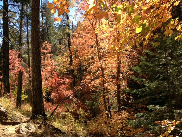
Quick update. Fall colors are peaked out at the top of Mt. Lemmon outside of Tucson, AZ. We hit the Marshall Gulch trail head on 10/21 and snapped the pics below. Not too bad for Tucson!

Tucson AZ Fall colors October 21 2012
Fall colors at Mt. Lemmon

Marshall Gulch colors October 2012


Wednesday, October 17, 2012

Rocky Mountain National Park Hiking, Estes Park Colorado

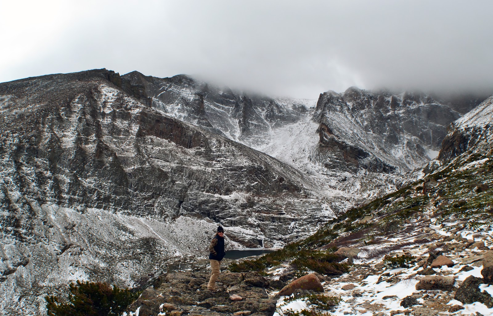
Chasm Lake on the way to Longs Peak
Looking down into Chasm Lake
We took a long weekend trip the last weekend in October to get some hiking in.  Luckily work had me in Steamboat Springs for a few days and made it easy to extend the trip into the weekend.  Neither of us had been in Rocky Mountain National Park before so we very anxious to get this trip in.  Being a bit late in the season we were hoping that we got to see some of the fall color before it was gone and also got to hit the trails before the snow covered it up too much.  The weather forecast was a bit iffy with a 50% chance of snow in Estes Park.  We awoke in the morning with decent weather, so it seemed, so we decided to give it a shot.  Most of the fall colors were gone, but we got pretty lucky with some good hiking weather at the start of our hike.

Our trip started at the Longs Peak parking lot/trail head.  Luckily the weather forecast must have scared off most of the casual hikers as the parking lot was for the most part empty at 10 am.  From what I read this isn't usually the case at Longs Peak as it's one of the busier trails in the national park.  Their loss!  We certainly weren't prepared to hike to Longs so we chose Chasm Lake as our destination for this trek.  The Chasm Lake hike is about 9 miles round trip and you gain about 2500' in elevation.  It isn't too challenging, but the wind and snow once we came above the tree line made it a little rough.


As you come up to the top of the ridge about 3.5 miles in you'll reach an intersection.  The trail to Longs peak goes to the right and the Chasm Lake trail heads to the left past a bathroom.  Follow this route down to the lake.  The new snow and storm surely gave us some unique views and photo opportunities.  The weather was pretty good until we got near the lake.  Once there a storm blew in with 30-40mph winds and heavy snow.  I can't imagine it was more than 25 degrees outside at the same time.  A bit cold especially with the wind.  We snapped a few pics and quickly heading back to the shelter of the tree line.  All in all it was a great hike.  The snowcapped mountains really created some amazing views and pictures.  If you're in the area I certainly recommend to heading up to Rocky Mountain National Park and hiking up to Chasm Lake.

Video of the weather:


Here are some pics from the trip:

Chasm Lake hike photos
Looking down into Chasm Lake as the snow storm blew in
Chasm Lake trail intersection with longs peak
Katie at the first intersection with the storm starting to move in
Snow storm at Chasm Lake near Longs Peak
Heading back in the storm
Hiking to Chasm Lake Rocky Mountain National Park
Above Chasm Lake on the ridge

A quick video of the Chasm Lake hike I found on YouTube.

Monday, October 8, 2012

Tucson, AZ Fall Colors Update

10/8 - Tucson , AZ - Headed up to the top of Mt. Lemmon this past weekend and hit the Aspen Trail and Marshall Gulch trail.  The Aspens have just started to change the leaf colors.  Most some yellows but there were definitely some good areas along Marshall Gulch with oranges and reds.  We probably still have 2 weeks until the fall colors peak.  Either way the weather is perfect for hiking!